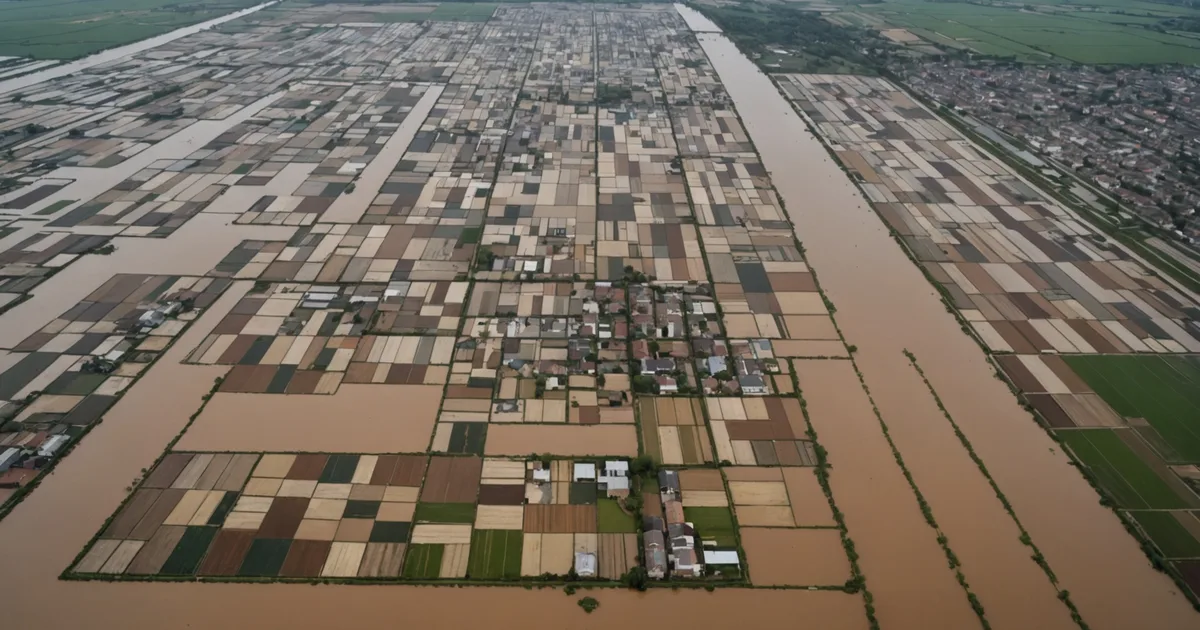
Flood events create a logistics problem that does not resemble normal distribution operations in any meaningful way. The road network changes faster than any routing system can track if it relies on standard map data. The population requiring aid is mobile and concentrating in ways that were not predictable before the event. The available vehicle fleet is often partially diverted to evacuation, assessment, or water rescue, so logistics capacity is lower than normal at precisely the moment demand is highest.
Manual routing under these conditions fails in a predictable way: coordinators build a delivery plan based on whatever road status information they have at the moment of planning, that information becomes outdated within a few hours as road conditions continue to change, and the plan is increasingly disconnected from the physical reality on the ground by the time vehicles are dispatched. The result is failed delivery attempts, vehicles diverted en route, and a fragmented picture of what has actually been delivered and what has not.
The Road Network Degradation Timeline
In a significant flood event, road accessibility follows a consistent degradation pattern. The first 12-24 hours are characterized by primary road closures: major bridges and low-lying stretches of primary highways go first. The secondary network remains largely accessible and becomes the primary routing infrastructure for the initial response period. Between 24 and 72 hours, secondary roads in areas with drainage problems begin to flood, and the accessible network contracts further. The tertiary and local road network, which is often the only way to reach isolated communities in rural flood-affected areas, may remain partially accessible in some areas and be fully submerged in others with no consistent pattern.
The critical challenge for a routing system is that this degradation does not follow the static priority hierarchy of the road map. A secondary road through an elevated corridor may remain accessible while the primary highway two kilometers away is flooded. A local farm track that would never appear in standard routing data becomes the only viable route to a cluster of isolated households. The routing system needs to update its understanding of the accessible network continuously, and that updating requires real-time data inputs rather than a static map overlay.
Partial Network Availability and Alternative Route Generation
When a routing system operates on a partially available network, the quality of its alternative route generation depends entirely on whether it has current status information for the segments being evaluated. A system that marks a corridor as "closed" and plans around it, without knowing the current status of the alternative corridors, may generate a rerouted path that is also inaccessible. Worst case, you get a planned route that requires passing through multiple closed segments, which a driver discovers in sequence as failed turns rather than all at once.
In a 2025 flood response pilot in a river basin region, a logistics cell was coordinating aid delivery to 14 distribution points across an affected area. At the start of the response, the team had confirmed road status for about 40% of the relevant network, with the remaining 60% either unconfirmed or known to be partially passable with uncertainty. Using a routing approach that treated unconfirmed segments as passable unless specifically flagged as closed produced routes that encountered blocked segments at roughly the rate you would expect given the confirmation gap: drivers reached blocked points on about a third of initial delivery attempts.
Switching to an approach that treated unconfirmed segments as having an elevated traversal cost (not fully closed, but not fully reliable either) and prioritized routes through confirmed-accessible segments produced significantly fewer blocked delivery attempts, at the cost of longer planned route distances. The key insight is that in a degraded network, route reliability is more valuable than route efficiency. A route that you can be confident will work is worth considerably more than a theoretically shorter route with uncertain traversability.
Demand Concentration and Dynamic Distribution Point Management
Flood response logistics faces a demand signal problem that normal distribution operations rarely encounter. The people requiring aid are moving, often rapidly and in response to changing flood conditions. A community of 400 people may absorb 200 people sheltering from an adjacent flooded neighborhood within 12 hours, doubling the effective demand at that location without any advance notice. A community that had 600 residents at the start of the flood may have evacuated to 50 by the time the first delivery arrives because the area became inaccessible for habitation.
Routing systems that treat distribution point demand as fixed inputs to the planning process miss this dynamic. The demand at any given point is a function of current population, which is changing. A distribution plan built on Day 1 population estimates may be substantially miscalibrated by Day 3 if population movement is significant.
The practical response is to treat distribution points as adjustable rather than fixed, updating both their location and their demand estimate as the first delivery cycle produces ground-truth information. Delivery coordinators at each point can report current headcount via a simple radio or app check-in, and that information updates the demand estimate for subsequent planning cycles. Distribution points in areas that have been substantially depopulated get reduced allocation. Points experiencing population influx get increased priority and allocation. The routing plan for each cycle is built on the most current demand estimates rather than the pre-event population map.
Vehicle Capacity Allocation Under Uncertainty
The vehicle allocation problem in a flood response differs from normal distribution in a key way: vehicle capacity is not a fixed input to the optimization. In normal operations, you know how many vehicles you have and approximately what they can carry. In a flood response, vehicles that were available in the morning may have been diverted to evacuation support by the afternoon, and the total logistics capacity is unknown until you check at dispatch time.
This means the routing plan needs to be built with explicit uncertainty about total capacity, and needs to prioritize delivery sequence in a way that ensures the highest-priority distribution points are served even if the fleet turns out to be smaller than planned. A routing plan that assigns the highest-priority locations to the later legs of a multi-vehicle dispatch is a fragile plan: if two vehicles get diverted to other needs, the high-priority locations at the end of the sequence are the ones that go unserved.
Priority-first sequencing, discussed in the context of emergency logistics more generally, is the specific routing technique that addresses this: build routes so that high-priority stops are assigned to initial delivery cycles, with lower-priority stops filling remaining capacity. If the fleet turns out to be smaller than planned, the coverage gaps are in the lower-priority locations, not the critical ones. This does not require knowing in advance how much capacity will be available. It requires organizing the routing plan so that capacity reduction degrades coverage in the right direction.
What AI Routing Adds in This Context
We want to be specific about what a routing system does and does not provide in a flood response, because the value claim is sometimes overstated. What a well-designed routing system provides is: continuous re-optimization as road status updates arrive, so that the delivery plan at any given moment is built on the most current network information rather than the plan from six hours ago. It provides the ability to evaluate multiple routing scenarios quickly when network conditions are uncertain. It provides tracking of delivery completion and outstanding delivery commitments across the full fleet, so that coordinators have a current picture of what has been delivered and what has not.
What it does not provide is ground-truth road status. That comes from drivers, field teams, and local partners who are physically present in the affected area. What it does not replace is the judgment of experienced logistics coordinators who understand the operational context in ways that a routing algorithm cannot. What it cannot do is anticipate the next wave of road closures before they occur.
The value proposition is more modest but real: getting the routine computational work of route planning done faster and on more current data than manual planning can achieve, so that coordinator time is available for the decisions and coordination tasks that require human judgment. In a flood response with 14 distribution points and a partially available road network, that is worth a considerable amount.